


Drone data at the edge: three steps to better AI insights

Contents |
[edit] Drones and Artifical Intelligence
Data from drones can be hugely valuable. From surveying land to inspecting infrastructure, using drones offers greater accuracy and quicker access to insights than traditional methods. But it also generates a vast quantity of data and, of course, that presents challenges. Beyond the obvious storage capacity needed, wading through terabytes of information can mean some architects are missing out when it comes to getting the most from their drone data.
Enter AI. Offered up as a solution to unlock the power of data, AI has capabilities that could help architects, and other sectors that handle large volumes of data, to access insights and improve business outcomes. Algorithms to process and analyse drone data in real-time, for example, promise to speed up decision-making. Machine-learning algorithms have the capacity to identify patterns, anomalies and trends, and automating repetitive tasks like image recognition, feature extraction and classification can limit user error and free up time to focus on the jobs AI cannot do.
Without the right infrastructure in place, though, AI could fall short of the high expectations we all have for it. And all that valuable drone data could be left to languish in storage.
If AI solutions struggle to access data stored in edge locations, or if they access out of date information, the resulting insights will be inaccurate at best. At worst, the information produced could mean firms fall foul of regulations or are left open to legal challenge.
It all stems from how AI accesses information; we must make sure AI is analysing and learning from the right data. That means stepping back and looking at the way we store data in the first place. If files are stored in silos, locally with no global access, or if there are multiple versions, AI has to work so much harder, and that makes it more difficult to trust its insights.
[edit] Three steps to providing AI tools with the right access to drone data
The good news is that there are simple ways you can provide your AI tools with the right access to drone data, or any other data for that matter. To get started, I usually suggest the following three steps for the most targeted impact.
[edit] Provide instant access to data
If someone gave you out-of-date information and asked you to make a critical business decision, you would be worried. The same goes for AI. With real-time access to data, AI algorithms can analyse data streams as they are generated, provide immediate insights on emerging trends, and respond to changing circumstances or unusual patterns. By making sure AI has access to the most recent drone data, your plans and ideas will be based on what is happening right now, rather than an old snapshot from months ago.
[edit] Think always-on
Imagine, you are putting together a project proposal. You are relying on AI insight into a land survey carried out by one of your drones, but at a crucial moment an outage stops everything in its tracks. AI algorithms rely on a constant stream of data to learn, adapt and make informed decisions in real-time. If access to data is interrupted, whether that is through connectivity issues, downtime or datacentre failure, it could dramatically impact results. So prioritise continuous availability to your data and ensure AI solutions can access critical files and data at any time, regardless of network disruptions.
[edit] Prioritise version control
AI using outdated data is likely to generate inaccurate assessments of site progress, for instance miscalculating building dimensions or overlooking recent structural changes. Project managers taking decisions with these flawed insights could go on to allocate the wrong resources or make design modifications that simply will not work. So if data is stored across different systems and locations, look for ways to automate file updates so that changes are reflected immediately wherever they are stored. And think about how you will track changes, manage revisions and maintain a clear audit trail of data modifications, so that your AI model can readily identify the most recent version.
[edit] Conclusion
AI offers so much potential, especially when it comes to handling large data sets like those we see produced by drones. Opening up AI’s access to accurate, up-to-date information will help to unlock your data’s true value. Without that access, the technology’s results will be limited and it will be it impossible for us to realise its true potential.
This article appears in the AT Journal iseue 150 Summer 2024 as 'Drone data at the edge: three steps to better AI insights' and was Jimmy Tam, CEO of Peer Software.
--CIAT
[edit] Related articles on Designing Buildings
- 3D city model.
- 3D concrete printer
- 3D printer.
- Construction cameras.
- Construction drones.
- Building information modelling.
- ConTech.
- Drones as a Service DaaS.
- Drone data at the edge: three steps to better AI insights.
- Drone regulations and safety.
- Global positioning systems and global navigation satellite systems.
- Ground control point GCP.
- Ground sample distance GSD.
- How can drones transform construction processes?
- Interferometric synthetic aperture radar InSAR.
- Interview with David Southam about laser scanning in construction.
- Laser.
- LIDAR.
- Mitie - drone pest control inspection.
- Paint by drone.
- Pixel.
- Post processed kinematic PPK.
- Prefabrication.
- Printing 3D models of buildings.
- Real time kinematic RTK.
- Site information.
- Site surveys.
- Surveyor.
- The use of drones in the construction of Crossrail.
- TruVision.
- Unmanned aerial system.
- Uses of drones in construction.
- Using drones for inspection and survey.
- Using satellite imagery to monitor movements in megaprojects.
Featured articles and news
ECA progress on Welsh Recharging Electrical Skills Charter

Working hard to make progress on the ‘asks’ of the Recharging Electrical Skills Charter at the Senedd in Wales.
A brief history from 1890s to 2020s.
CIOB and CORBON combine forces

To elevate professional standards in Nigeria’s construction industry.
Amendment to the GB Energy Bill welcomed by ECA

Move prevents nationally-owned energy company from investing in solar panels produced by modern slavery.

Gregor Harvie argues that AI is state-sanctioned theft of IP.

Heat pumps, vehicle chargers and heating appliances must be sold with smart functionality.
Experimental AI housing target help for councils
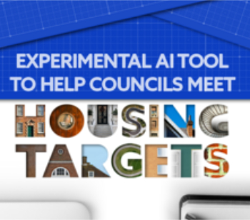
Experimental AI could help councils meet housing targets by digitising records.
New-style degrees set for reformed ARB accreditation

Following the ARB Tomorrow's Architects competency outcomes for Architects.
BSRIA Occupant Wellbeing survey BOW
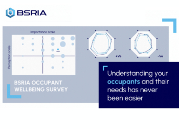
Occupant satisfaction and wellbeing tool inc. physical environment, indoor facilities, functionality and accessibility.

Preserving, waterproofing and decorating buildings.

Many resources for visitors aswell as new features for members.
Using technology to empower communities

The Community data platform; capturing the DNA of a place and fostering participation, for better design.
Heat pump and wind turbine sound calculations for PDRs

MCS publish updated sound calculation standards for permitted development installations.
Homes England creates largest housing-led site in the North

Successful, 34 hectare land acquisition with the residential allocation now completed.
Scottish apprenticeship training proposals

General support although better accountability and transparency is sought.
The history of building regulations

A story of belated action in response to crisis.
Moisture, fire safety and emerging trends in living walls

How wet is your wall?

Current policy explained and newly published consultation by the UK and Welsh Governments.

British architecture 1919–39. Book review.

Conservation of listed prefabs in Moseley.

Energy industry calls for urgent reform.